
Storms dumped several inches of rain onto parts of the region in a short amount of time Wednesday, causing flash floods and flooding in D.C. and surrounding counties in Maryland and Virginia during the evening rush.
A month's worth of rain pounded many areas in just a few hours, Storm Team4 Meteorologist Ryan Miller said.
A flood warning is in effect until 8:45 a.m. for Prince George's County as showers linger on Thursday morning. The National Weather Service reports flooding in the Upper Marlboro area. Other flood warnings and watches have expired. Here's a full list of severe weather alerts.

We've got the news you need to know to start your day. Sign up for the First & 4Most morning newsletter — delivered to your inbox daily. Sign up here.
Rainfall Totals
Storm Team4 said more than 4 inches of rain have fallen in Prince George's County, 2.5 inches in Northeast D.C. near Minnesota Avenue, more than 3 inches at the Beltway and Route 301 and 1.5 inches in downtown D.C.
Flooded Roads in D.C. Area
Cars stranded in flood waters are blocking traffic on the Capital Beltway outer loop in Greenbelt, Maryland.
Flooding has also shut down the southbound lanes of the 3rd Street Tunnel in D.C. Police said the New York Avenue NW and Massachusetts Avenue NW tunnel exits are closed due to high standing water. They are diverting traffic to 4th Street and New York Avenue NW, and asking drivers to use alternate routes.
Other road closures include Rhode Island Ave NE near the metro station and Lawyers Road near Hunter Mill Road in Vienna, Virginia.
Remember: If you're driving and you see standing water, turn around and don't drown.
The D.C. area has grappled with disrupting flooding lately: District Dogs day care on Rhode Island Avenue was inundated with high water over the weekend, and drivers in the Riverdale, Maryland, area were swept away by floods during the Monday evening commute.
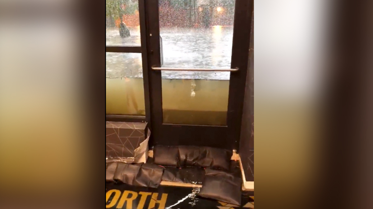
Wednesday's storms flooded District Dogs once again. Cloudy, brown water was seen rushing above a door — just a few inches shy of the handle.
Flash flooding can quickly create dangerous conditions on the roads. Never drive into a flooded roadway — the water could be much deeper than you think.
Weather Forecast: Relief from Storms, Heat on the Way
Wednesday was another hot and sticky day before the storms, with the heat index reaching 99° before noon.
It could be our last day at 90° for a while.
By Thursday, our shifting weather pattern will give us a hint that summer is winding down. Expect cooler, less humid air to settle in. Here's the Storm Team4 forecast.
Thursday is set to begin with cloudy skies and more morning showers. Rain chances are set to diminish by noon to 2 p.m. Highs are expected in the 80° to 86° range.
Highs will be in the upper 70s to lower 80s through the weekend amid mostly sunny skies.
Cool mornings will come on Saturday and Sunday as temperatures drop to near 60° in D.C. and well down into the 50s for areas north and west of Dulles International Airport.
The heat will not come back next week, but rain chances will. Make the most of the weekend sunshine.