A wintry mix is headed toward the D.C. area and forecast to push into the region Monday, creating a chance for 2021’s first noteworthy snow and ice.
Snow lovers in the D.C. area will probably have to wait longer to see a blanket of flakes on the ground, however.
We're making it easier for you to find stories that matter with our new newsletter — The 4Front. Sign up here and get news that is important for you to your inbox.
Rain and a wintry mix, possibly of freezing rain, will move into the area during the midday and afternoon hours on Monday and continue into the night. Some ice and snow are possible north and west of Washington, with some minor snow accumulations possible around the Maryland-Pennsylvania border and around the Interstate 81 corridor.
There could also be some ice accumulation, which is more treacherous.
Temperatures in most of the D.C. metro area and to the south look to be too warm to support anything but rain.
Weather Stories

This forecast is subject to change as details become clearer over the weekend. Storm Team4 will continue tracking this system.
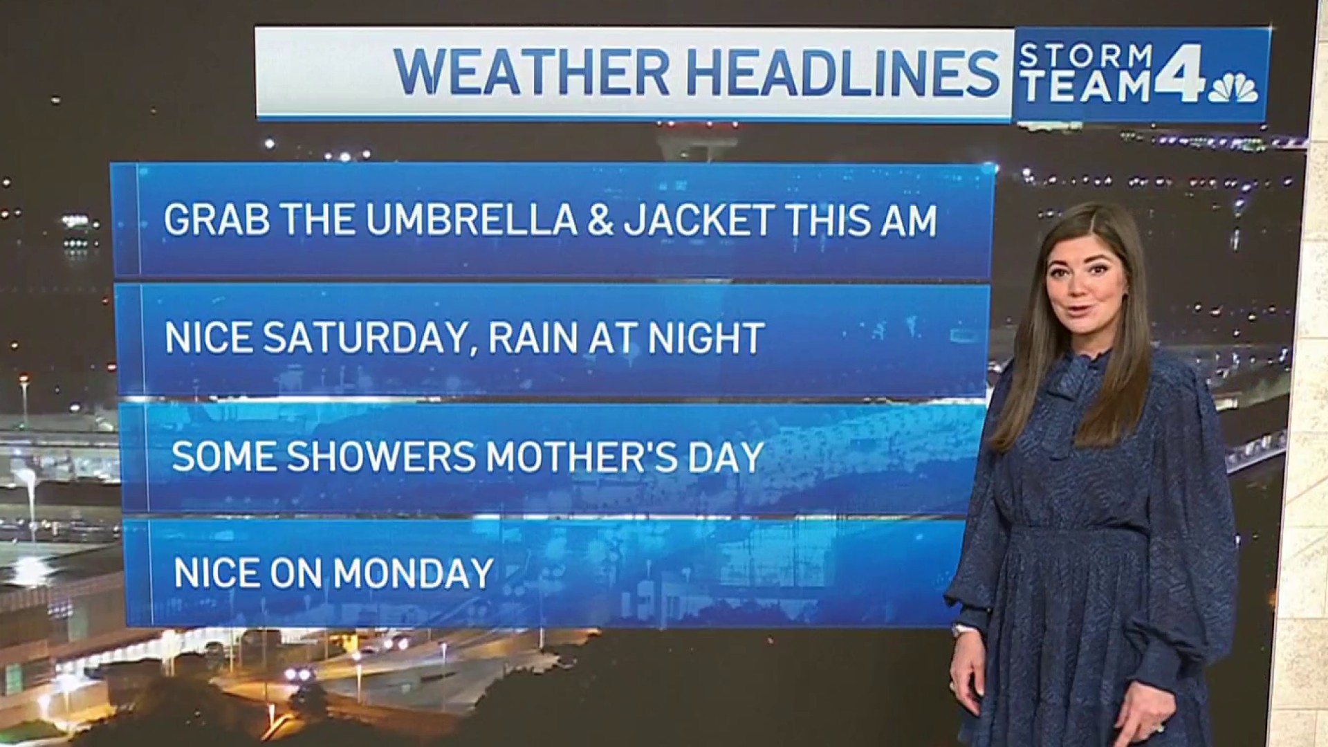
Bundle up when you get outside over the weekend: It will be sunny, but cold.
Saturday will be the coldest day with wind gusts up to 40 mph and wind chills in the teens and 20s.
Sunday is the pick day of the weekend, with lighter wind and temps in the 30s to near 40°. Clouds will increase ahead of the storm.
The forecast suggests that rain or wintry mix could stick with us throughout Monday and into Tuesday amid temperatures in the mid- to upper 30s.
Stay with Storm Team4 for the latest forecast