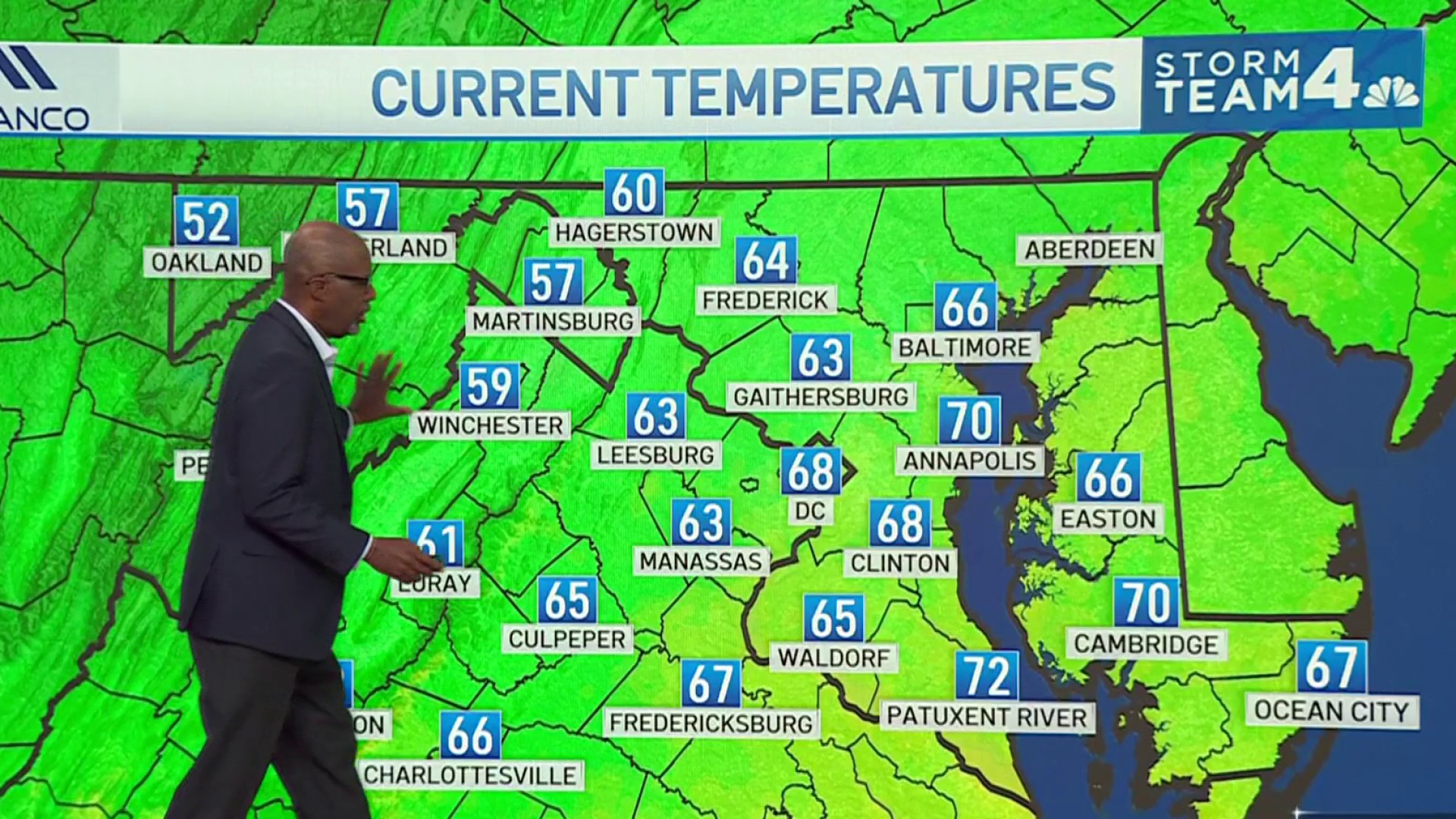
Don’t expect a lot of intense heat this summer, but it looks like a more humid season than last year, Storm Team4 Chief Meteorologist Doug Kammerer predicts.
It also could be an active season for hurricanes, though conditions could keep them mostly off the coast.
What to know about hurricanes for summer 2024
We’re coming out of El Niño and moving toward La Niña, which helps create hurricanes. And a warmer-than-average Atlantic Ocean could mean more intense hurricanes.
We're making it easier for you to find stories that matter with our new newsletter — The 4Front. Sign up here and get news that is important for you to your inbox.
But the Bermuda High — high pressure centered near Bermuda during the summer months — will be further east this summer, which won't allow the heat to come up from areas such as the Gulf of Mexico. That bodes well for the development of hurricanes. They may occur in the Gulf of Mexico, but storms that form in the Atlantic Ocean may stay out to sea.
The jet stream pattern will move up into Canada before coming down across the D.C. region, creating a trough of low pressure along the East Coast, which should also help keep any hurricanes out to sea.
Expect an above-average storm season, with 16 to 21 named storms (the average is 14) and nine to 11 hurricanes (there’s usually five to seven), with three to five major hurricanes that should stay off the coast.
Weather Stories
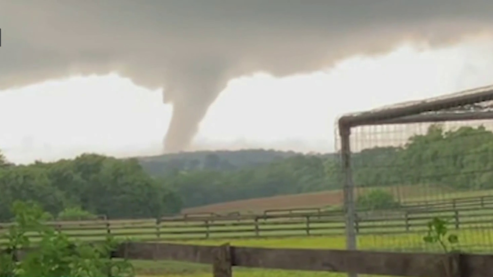
But in late August, look for the potential of a hurricane which could make its way up the East Coast, hopefully staying just offshore.
What to know about heat & humidity for summer 2024
The jet stream pattern also means the D.C. area shouldn’t see a lot of intense heat. Expect about 38 to 46 days of 90° temps (the average is 45) but no 100° days.
But a more humid season will mean heat indexes rising above 100°.
Be prepared for your day and week ahead. Sign up for our weather newsletter.