Storm Team4’s Chuck Bell has the forecast for Tuesday and the days ahead.
The D.C. area is getting a taste of spring before wintry weather returns later in the week.
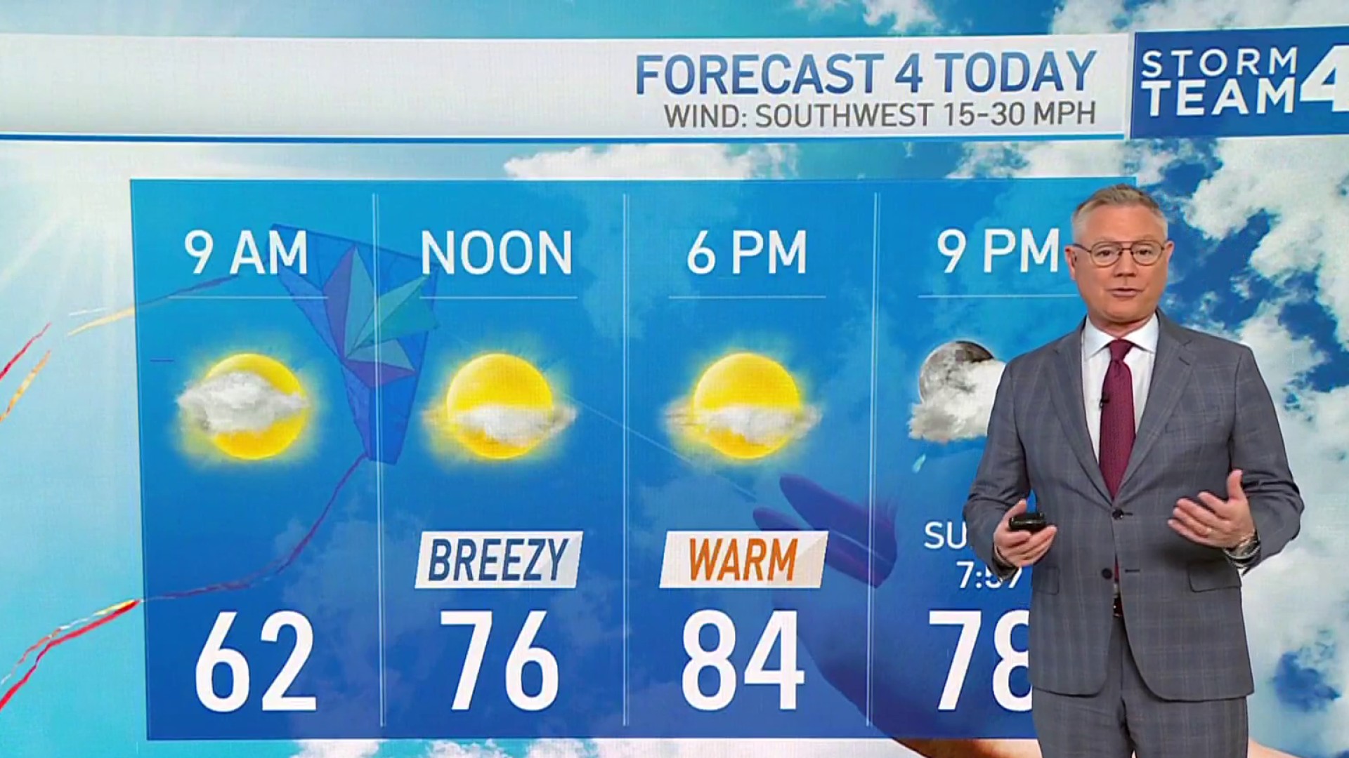
Tuesday has been mild, but wet with showers and temperatures in the 60s. Storm Team4 said there isn't a lot of rain left of the storm system, but more showers could move in overnight.
Stream NBC4 newscasts for free right here, right now.
Parts of Southern Maryland could get some rain about 7 or 8 a.m., but the D.C. area will be dry, Storm Team4 Chief Meteorologist Doug Kammerer said.
We have the news you need to know to start your day. Sign up for the First & 4Most morning newsletter — delivered to your inbox daily.
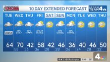
Wednesday will be the warmest day of the week. Sunshine will push temperatures to about 70° by noon.
Bring warm layers to evening activities Wednesday, though, because temperatures will drop dramatically — from the high 60s at sunset to the upper 40s by 8 p.m.
Aside from the nice, spring-like weather expected Wednesday, the area is on the cool side for much of the 10-day forecast, Kammerer said.
Weather
Latest weather forecast, live radar and weather maps for Washington, D.C., Maryland and Virginia
"Enjoy what you can experience tonight and tomorrow as far as the warmth goes. It may not return for a while," he said.
Thursday will be ideal for curling up at home with hot cocoa amid an 80% rain chance and temps in the 30s. There could still be a few wet snowflakes well north and west of D.C., but no snow accumulations are likely south of the Pennsylvania border.
Cold air will briefly retreat on Friday, allowing highs to reach the 50s, before returning on Saturday. Expect highs in the 40s over the weekend and colder than average conditions into early next week.
10-Day Extended Forecast for DC, Maryland and Northern Virginia