

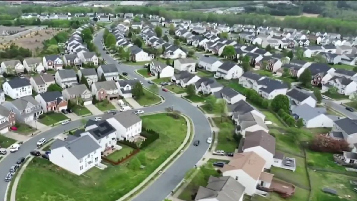
Aerial images of property can wind up costing homeowners when it comes to insurance as some companies use them to determine whether a property is too risky to cover.
Almost every building in the United States is being photographed by satellites or drones as part of the industry-funded Geospatial Insurance Consortium that uses aerial imagery to help insurance companies keep an eye on their policyholders.
Elizabeth Davis found out her insurance company, Nationwide, was taking pictures of her roof after getting an email saying “imagery data” from a third party caused concerns that may “increase the chance for a loss on the property.”
“It felt kind of icky,” Davis said. “And it felt just kind of like somebody’s watching you.”
We're making it easier for you to find stories that matter with our new newsletter — The 4Front. Sign up here and get news that is important for you to your inbox.
There was “natural discoloration and streaking,” and the remedy was to repair or replace the roof in order to retain Nationwide.
“I had a panic attack,” Davis said.
She said she was floored to know her policy could be revoked because of a grainy image she didn’t even know was being taken.
Consumer


“When we moved in, we knew that we were going to have to replace the roof within, you know, a few years,” Davis said. “Was it something that I planned on doing in the next three months? No.”
“I would say in the last 10 to 15 years we’ve really seen the use of drones and aerial photography and satellite imagery come into the insurance space,” said Sean Kevelighan of the Insurance Information Institute, an industry association.
Aerial imagery originally was used during catastrophic events when humans were unable to reach certain areas destroyed by severe weather, Kevelighan said. It was safer and faster to pay claims.
Today, drones and satellites are being used for normal maintenance of policies by many insurance companies, Kevelighan said.
Insurers look for underwriting hazards like yard debris, damaged roofs, undeclared trampolines and swimming pools.
“I would say the technology, as much as it might be jarring to a consumer to understand that the insurer is monitoring a house, to have a safer roof, to make sure that that first line of defense of your home is better protected, I'd say that's a win-win for the consumer,” Kevelighan said.
The use of drones or satellite imagery is legal to a point. State insurance divisions for both Maryland and Virginia said drones can be used to collect information. However, the Maryland Insurance Administration says there can be issues if drone imaging relies on technology such as artificial intelligence instead of human eyes to make decisions on potential risks. That’s why most states say insurers should rely on more than one source of information to determine risk. (Drones aren’t allowed in D.C.)
United Policyholders, a nonprofit that provides resources to consumers, says it has seen a dramatic increase in reports from consumers who’ve been dropped by their insurers on the basis of an aerial image, which they said could be “out of date or inaccurate.”
Davis said the image of her roof is more than a year old, which she knows because it doesn’t show the trampoline in her backyard that they installed a year ago.
News4 reached out to Nationwide about Davis’ case but did not receive a response.
She hired a company to inspect her roof and it found only a broken shingle and some bolts that needed to be sealed. She paid for the repairs the roofer suggested after getting approval from Nationwide, but her insurance company told her it wasn’t enough. Nationwide wants her to address the discoloration on the roof.
What to do if insurance company alerts homeowners to issues seen in aerial pictures
There are a couple of things homeowners can do if their insurance company uses an aerial picture of their property to identify issues:
- The homeowner has the right to ask to see the picture.
- The insurer must allow time to fix the problem or dispute the photograph.
The drones can’t be flown close and peek into windows.
And while the pictures can be used to drop homeowners, more often than not they may catch a problem homeowners can’t before it becomes very expensive to fix.
Sign up for our Breaking newsletter to get the most urgent news stories in your inbox.