


4 things to know about the weather:
- Few Showers Later Today
- Dry, Breezy Saturday
- Cloudy, Cool Sunday
- Sun Back On Monday
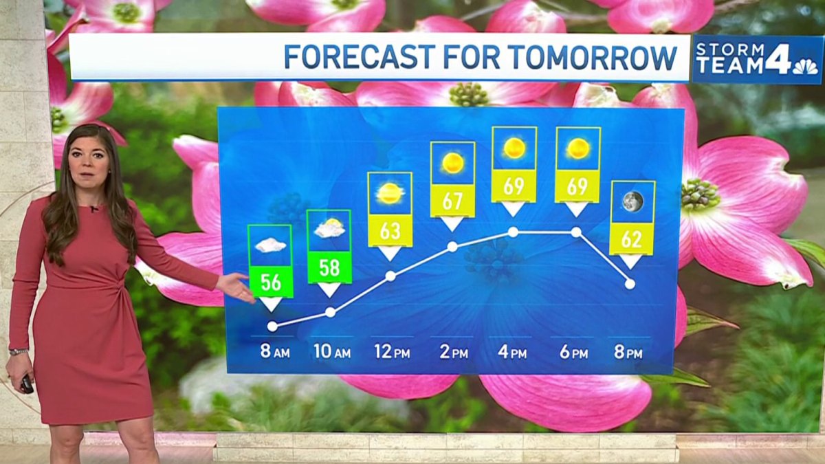
The clouds came back overnight and there will be precious little sunshine today. The added clouds will keep most areas in the mid-60s and chances for light rain and sprinkles increases for the afternoon and evening hours.
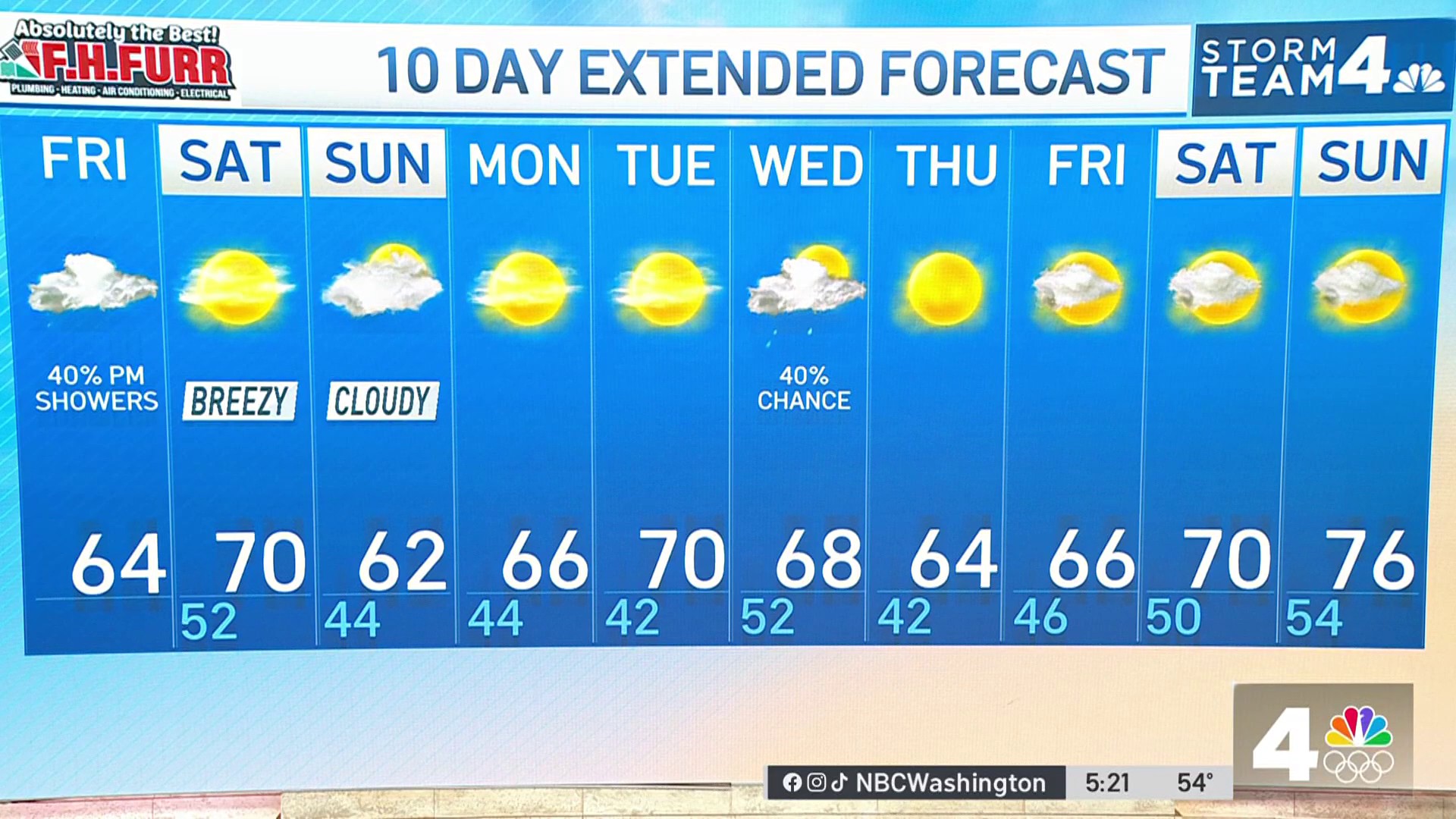
A weather front will come through overnight and bring an end to any rain chances just before sunrise Saturday morning. After a cloudy and damp start, sunshine will begin to return by 9-10 a.m. and the afternoon will be sunny, breezy and mild with highs near 70°.
We're making it easier for you to find stories that matter with our new newsletter — The 4Front. Sign up here and get news that is important for you to your inbox.
Saturday will be the better half of the weekend. A storm passing to our south on Sunday will not be close enough to deliver rain, but it will be close enough to turn our skies cloudy. Clouds will once again lead to afternoon highs staying in the low 60s.
That storm will be out to sea by Monday morning so sunshine returns for Monday and Tuesday with highs back near 70°.
As it looks now, our next chance for some beneficial rain won't arrive until the end of next week.
Pollen levels will remain high all next week and spring gardens will need to be watered… by you.
Weather radar:
Download the NBC Washington app on Apple and Android to use the weather radar on your mobile device.
10-day forecast

Quickcast:
TODAY:
Mostly Cloudy
Much Cooler
Some Light Rain / Drizzle
Wind: Southeast 5-15 mph
Chance Of Rain: 40%
HIGHS: 60° - 66°
TONIGHT:
Mostly Cloudy
Some Light Rain
Cool
Chance Of Rain: 40%
Wind: Variable 4-8 mph
LOWS: 46° - 54°
SATURDAY:
Mostly Cloudy Morning
Sunshine By Noon
Breezy, Milder
Wind: Northwest 12-22 mph
Chance Of Rain: 10%
HIGHS: 64° - 70°
SUNDAY:
Mostly Cloudy
Cool
Dry For Most
Wind: Northwest/West 5-15 mph
Chance Of Rain: <20%
HIGHS: 58° - 64°
MONDAY:
Mostly Sunny
Low Humidity
Steady Breeze
Chance Of Rain: 0%
Wind: Northwest 6-12 mph
HIGHS: 64° - 68°
Sunrise 6:25 Sunset 7:50
Average High: 70° Average Low: 50°

