Editor's Note: Go here for the latest forecast and potential storm impacts on Friday, Sept. 30.
What’s left of Hurricane Ian is set to hit the Washington, D.C., region over the weekend and dump rain over several days.
Now a tropical storm, Ian continued to batter Florida with wind and rain Thursday after making landfall as a Category 4. The storm is expected to make another landfall in South Carolina as it heads north.
In the D.C. area, rain is expected to arrive Friday. Moderate to heavy rain and scattered flooding are the biggest potential threats, the National Weather Service says. Wind may be an issue on the water and in high-elevation areas along the Blue Ridge Mountains.
We're making it easier for you to find stories that matter with our new newsletter — The 4Front. Sign up here and get news that is important for you to your inbox.
Virginia Gov. Glenn Youngkin declared a state of emergency on Wednesday to allow the commonwealth to mobilize equipment and resources.
“While we recognize that the storm track is still uncertain, I nevertheless encourage all Virginians and visitors to make a plan, have supplies on hand, and follow official sources for the latest forecast information and guidance,” Youngkin said.
A rainy, chilly and breezy weekend should be fine for indoor plans, but it’s time to rethink outdoor plans.
“It’s more of a nuisance forecast for us,” Storm Team4 Meteorologist Amelia Draper said. “We’re not going to be dealing with anything like what we saw in Florida.

Day-by-Day Weather Forecast in the DC Area
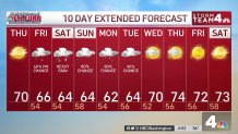
Thursday and the first part of Friday will be your best chance to prepare for several days of rain.
On Thursday, skies will turn cloudy during the afternoon as highs reach the 66° to 72° range.
Rain is expected to arrive in the D.C. area on Friday by about 5 p.m., moving from south to north. Overall, there’s a 40% chance of rain.
The heaviest rain is likely Friday night into Saturday morning just as the storm pushes in. Rain chances are 100% on Saturday and Sunday.
Unsettled, rainy weather won't depart until Wednesday, Storm Team4 says.
How Much Rain Will Fall?
Expect a solid 1 to 2 inches of rain to fall area-wide through Saturday evening. Some areas, especially south of Washington, could see 5 inches of rain or more.
High water is likely in the Tidal Potomac and the Chesapeake Bay due to steady onshore wind and multiple high-tide cycles, Storm Team4 says. Old Town Alexandria, Southern Maryland and the western shore of the bay are particularly exposed.
“A lot of high water is likely over the coming days,” Storm Team4 Meteorologist Chuck Bell said.
It won’t dry out until the middle parts of next week.
How to Prepare for Heavy Rain and Potential Flooding
Any time severe weather is in the forecast, it’s wise to make sure you’re prepared in case of the worst.
During hurricane season, take measures to reduce the impact of flooding around your home and prepare in case travel becomes difficult in your neighborhood.
Here are some tips and things to consider:
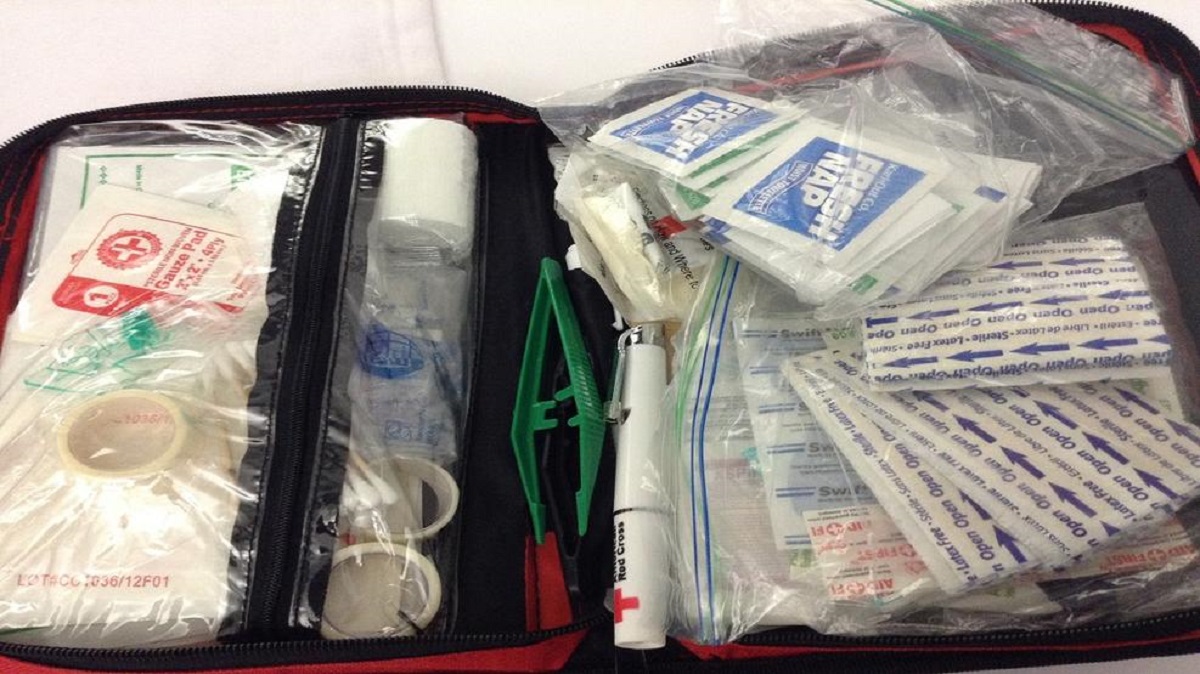
- Is your emergency kit stocked? Here’s a helpful guide on what you need from the Virginia Department of Emergency Management.
- Clean out gutters and storm drains, and ensure your sump pumps are working. Check that gutters are draining water as far from your home as possible.
- Pick up essentials, including medication, shelf-stable groceries and extra pet food, before bad weather arrives.
- Put new batteries in flashlights and put them in places that are easy to find, such as on your bedside table.
- Make communication and evacuation plans. Ready.gov has tools to help.


