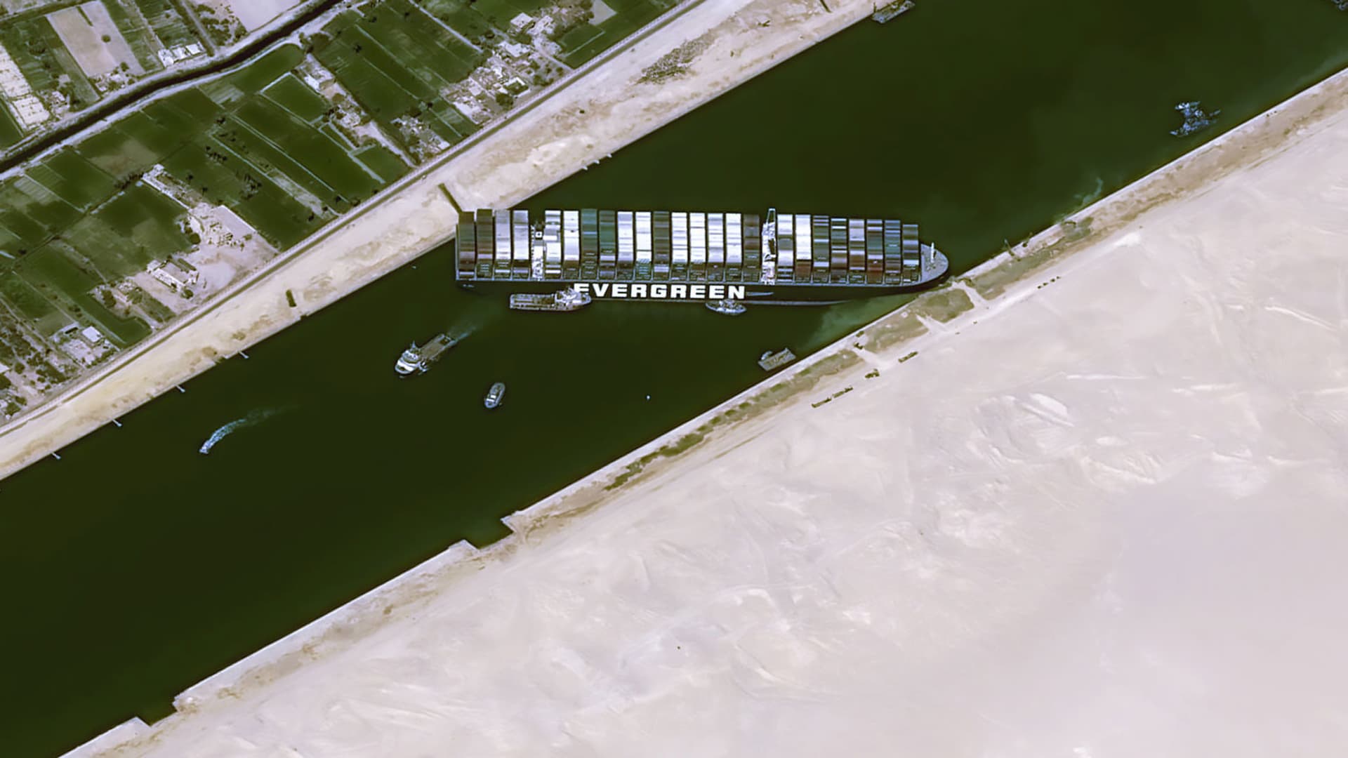
- Satellite images give a unique vantage point of the stuck ship Ever Given, as crews work to free the mega container vessel that's been blocking the Suez Canal for four days.
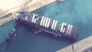
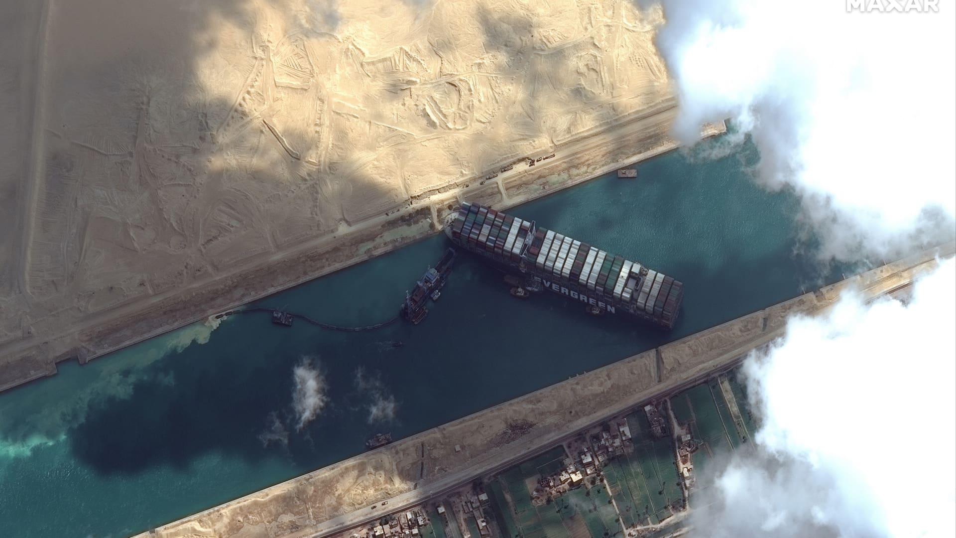
- Maxar Technologies' WorldView-2 satellite captured high-resolution images on Friday morning, with a close-up look at the dredging operations underway to free the ship.
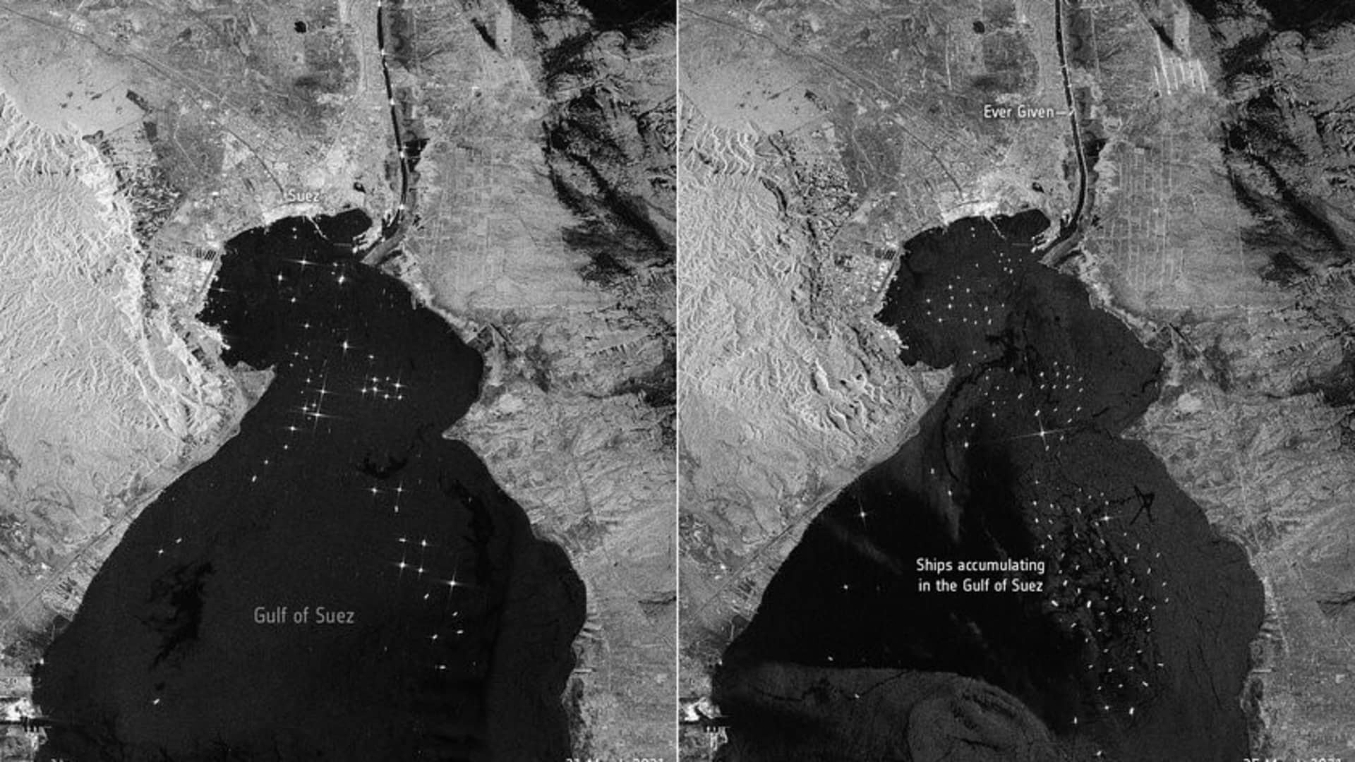
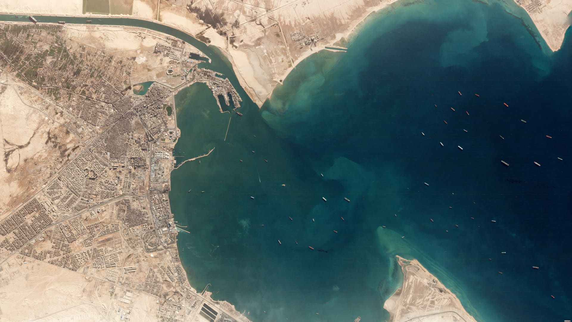
- Imagery captured by the European Space Agency's Copernicus Sentinel-1 satellite showed shipping traffic backing up in the Gulf of Suez.
Satellite images give a unique vantage point of the stuck ship Ever Given, as crews work to free the mega container vessel that's been blocking the Suez Canal for four days.
Maxar Technologies' WorldView-2 satellite captured high-resolution images on Friday morning, with a close-up look at the dredging operations underway to free the ship. The Ever Given, which is operated by Taiwanese shipping company Evergreen Marine, has been stuck since Tuesday, when the ship ran aground during the heavy winds and low visibility of a sandstorm.
We're making it easier for you to find stories that matter with our new newsletter — The 4Front. Sign up here and get news that is important for you to your inbox.
Shipping operators warn that it may take weeks to free the Ever Given. The enormous cargo carrier is more than 1,300 feet long and about 193 feet wide. It weighs more than 200,000 tons. One end of the ship is wedged into one side of the canal and the other stretches nearly to the other bank.
The ship is fully blocking the Suez Canal, through which an average of about 52 ships pass through per day, according to the Suez Canal Authority.
The canal handles around 12% of global seaborne trade, with each day of blockage disrupting more than $9 billion worth of goods — meaning each hour of delays is holding up an estimated $400 million in trade, according to data firm Lloyd's List.
Imagery captured by the European Space Agency's Copernicus Sentinel-1 satellite showed shipping traffic backing up in the Gulf of Suez. More than 150 ships are currently waiting for the Ever Given to be cleared, according to estimates from research firm StoneX.
Ships continue to wait, as rerouting around the southern tip of Africa significantly lengthens a trip. For example, sailing from the Suez Canal to Amsterdam takes about 13 days when traveling at 12 knots, compared with 41 days if traveling around Africa's Cape of Good Hope.
Planet Labs' satellite imagery gave another look at the traffic building in the gulf.
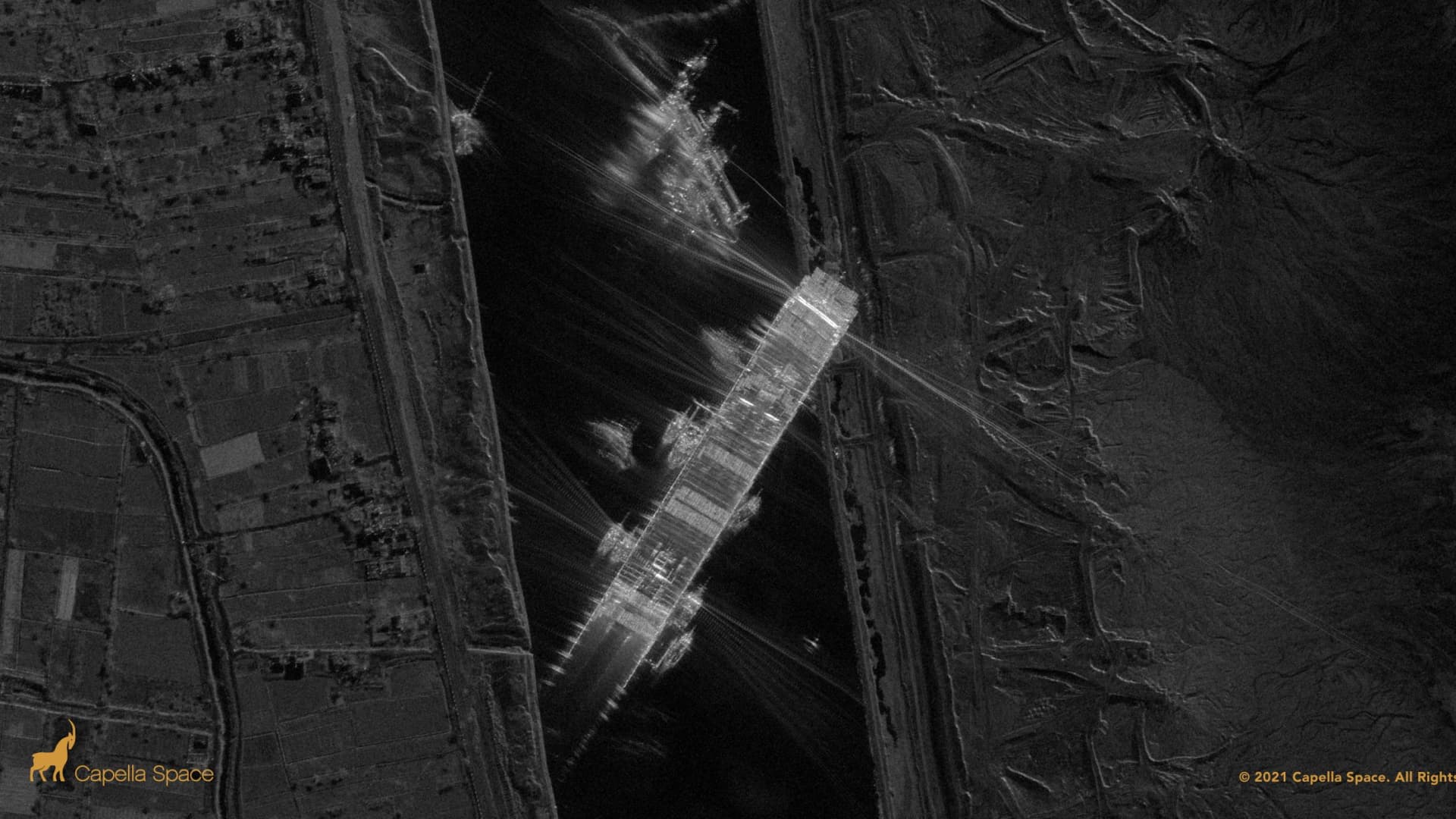
A synthetic aperture radar image captured by Capella Space on Thursday evening gave another look at the Ever Given, showing how deep it was wedged into the wall of the canal.
An image from an Airbus Pleiades satellite gives another angle on the ship, as the "off-nadir" view provides a more three-dimensional perspective of the Ever Given's situation.